
275.00 $ CA
Title
CHARTES & GUIDES NAUTIQUES MONTRÉAL AUX BAHAMA
Condition
Used
Presentation
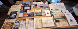
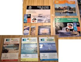
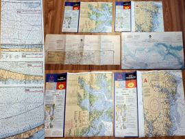
Idéal comme back-up à vos chartes électroniques. Datant de 2006/2007, toutes les cartes et guides pour aller de Montréal aux Bahamas, y compris Intracoastal Waterway et Floride jusqu'à Keys
Posted
May 01, 2024
Description
Plusieurs items vendus depuis publication originale
ENCORE DISPONIBLE:
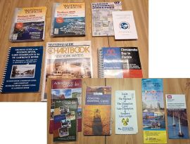
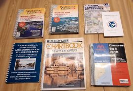
CHART KITS
• Block Island to Canadian border (Region 2)
• Norfolk to Florida, including Intracoastal Waterway (Region 6). Inclus CD Rom
• Near Bahamas Explorer Chartbook
• Exumas & Ragged Island Explorer Chartbook
• Far Bahamas Explorer Charbook
CHARTES
• Upper Cheasapeake Bay
• Lower Chesapeake Bay
• Miami to Elliott Key
• Matecumbe to Grassy Key
• Sugarloaf Key to Key West
• ICW: Edgewater to Mosquito Lagoon
• ICW: Titusville to Cocoa
• Port Canaveral & Banana river
• ICW: Melbourne to Sebastian Inlet
• Offshore: Ponce de Leon Inlet to Jupiter Inlet
CRUISING GUIDES
• Hudson River, Lake Champlain & St-Laurent
• New York Waters
• Canal Vacations Redefined
• US Army Corps of Engineers: Norfolk
ENCORE DISPONIBLE:
CHART KITS
• Block Island to Canadian border (Region 2)
• Norfolk to Florida, including Intracoastal Waterway (Region 6). Inclus CD Rom
• Near Bahamas Explorer Chartbook
• Exumas & Ragged Island Explorer Chartbook
• Far Bahamas Explorer Charbook
CHARTES
• Upper Cheasapeake Bay
• Lower Chesapeake Bay
• Miami to Elliott Key
• Matecumbe to Grassy Key
• Sugarloaf Key to Key West
• ICW: Edgewater to Mosquito Lagoon
• ICW: Titusville to Cocoa
• Port Canaveral & Banana river
• ICW: Melbourne to Sebastian Inlet
• Offshore: Ponce de Leon Inlet to Jupiter Inlet
CRUISING GUIDES
• Hudson River, Lake Champlain & St-Laurent
• New York Waters
• Canal Vacations Redefined
• US Army Corps of Engineers: Norfolk
Email
Location
West Island
Country
Canada
Provinces/States
Quebec
City
Pierrefonds
ZIP code
H9K 0B8

- 152 Views